Boundary Survey
Know exactly where your land begins and ends — certified and dispute-proof.
Full Details →Hail Enterprises has been delivering precise, government-compliant survey work across Mumbai's western suburbs for over 25 years. Every report is signed by Ivan Anthony D'Silva, Registered Private Land Surveyor (Reg. No. 1444183) — a name that builders, lawyers, and property owners across the region have trusted for decades.
Know exactly where your land begins and ends — certified and dispute-proof.
Full Details →Detailed land mapping for builders and developers — contours, levels, and features.
Full Details →Your building, placed exactly right — marked on site before construction begins.
Full Details →Click any WhatsApp button below to enquire about that specific service — Ivan will respond directly.

Know exactly where your land begins and ends — certified and dispute-proof.
A boundary survey is the most fundamental survey any landowner needs — and the most consequential if done wrong. Ivan measures and physically demarcates your plot’s exact boundaries as per government land records, ensuring every corner is accurately marked and documented. Whether you’re dealing with a neighbor encroachment, planning to build, or simply want certainty before a sale, a certified boundary survey from Hail Enterprises gives you a legally defensible record of your land.
Detailed land mapping for builders and developers — contours, levels, and features.
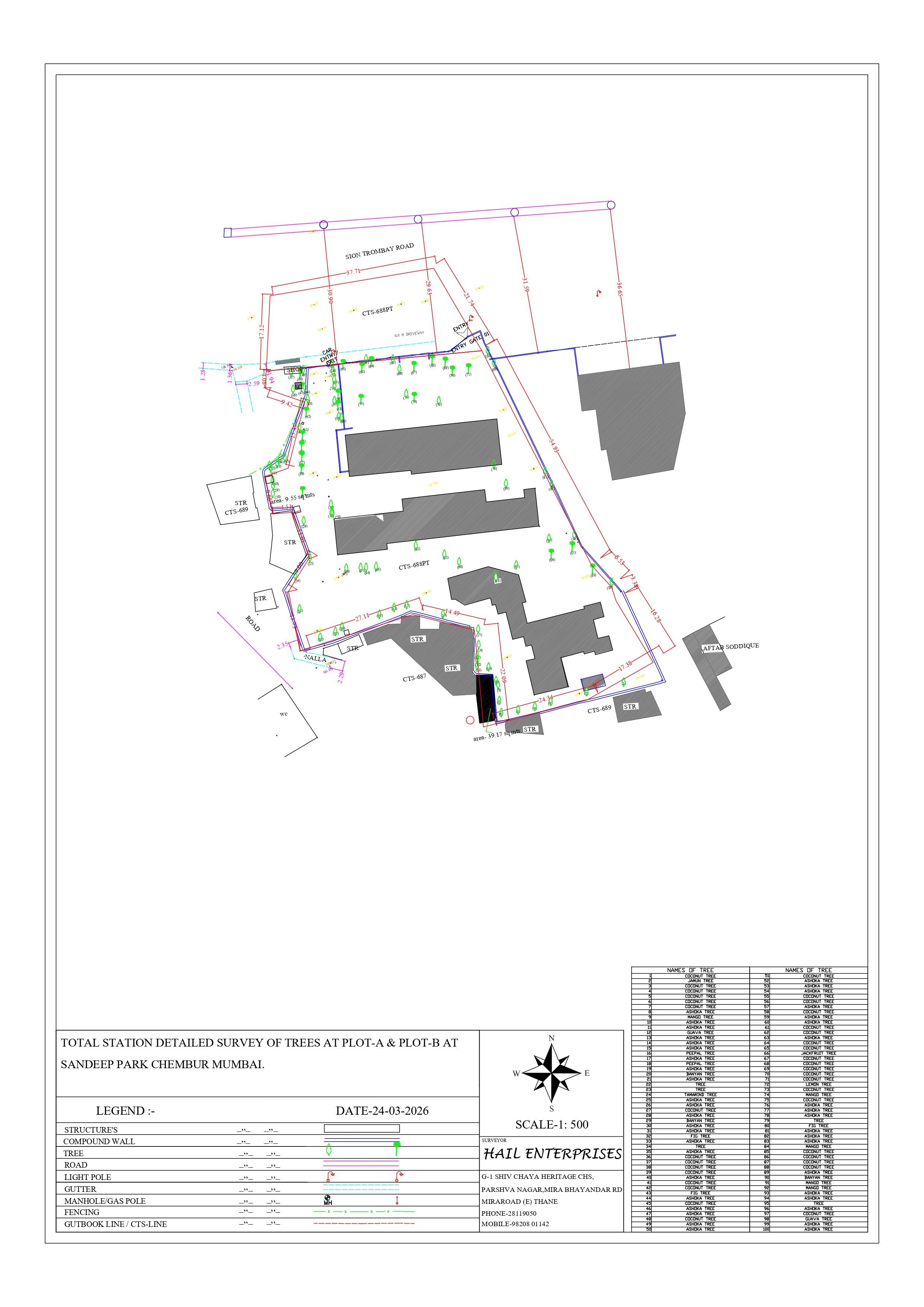
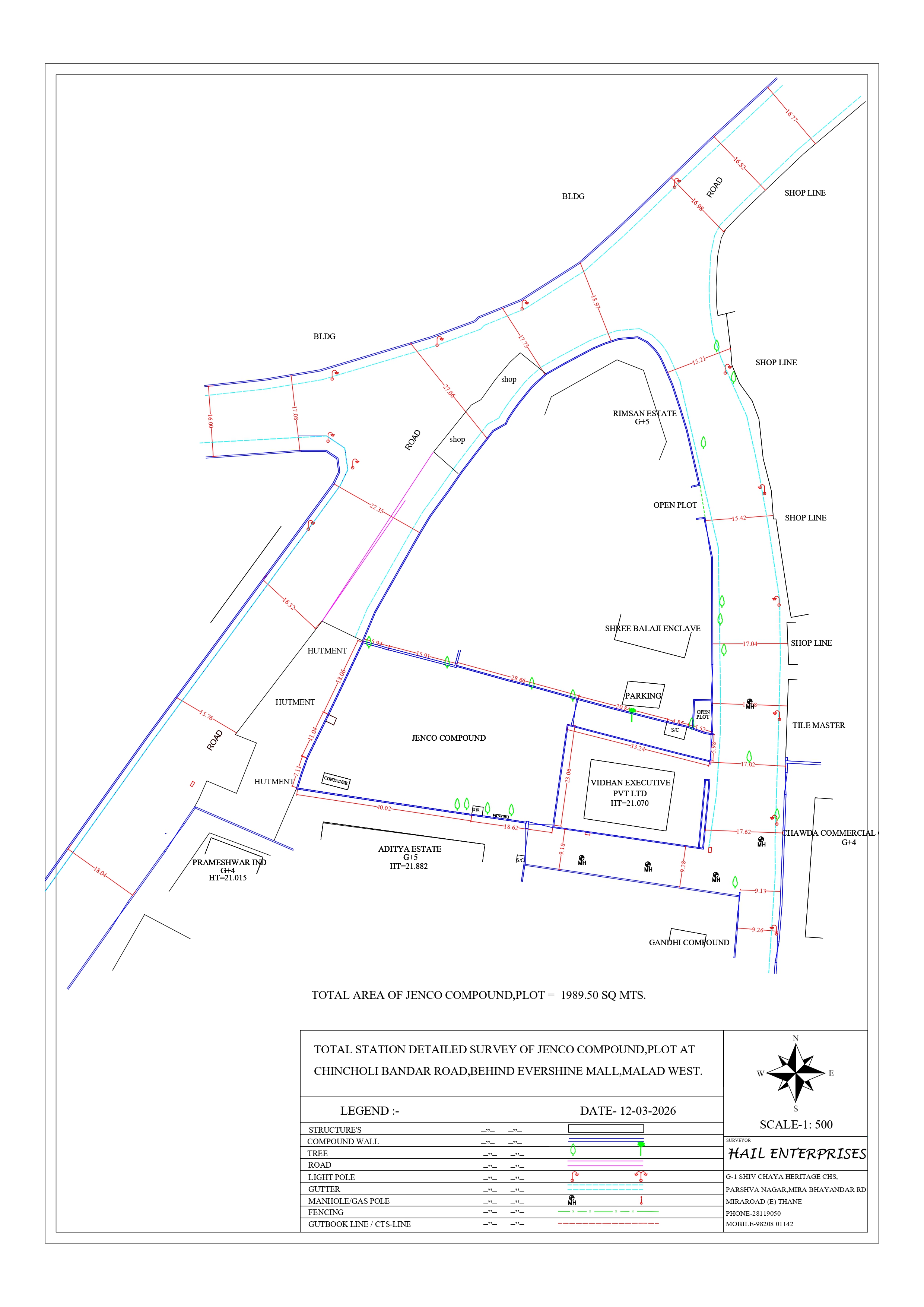
Before a single brick is laid, builders need to know exactly what they’re working with. A topographic survey from Hail Enterprises maps the complete physical profile of your land — elevations, contours, slope gradients, existing structures, drainage lines, trees, and any natural features. This is the foundational document that architects and structural engineers depend on to design buildings that are safe, compliant, and economical. Ivan has delivered topographic surveys for some of the most recognised builders in Mumbai’s western suburbs, including RNA Corp, Rustomjee, and Hiranandani.
Your building, placed exactly right — marked on site before construction begins.
A building layout survey translates your architect’s plans from paper to ground. Ivan precisely marks the proposed footprint of your building directly on the site — foundation lines, column positions, setback margins, and construction boundaries — ensuring your build starts in exactly the right place and stays compliant with local regulations. A misplaced layout can mean costly demolitions, legal disputes with neighbours, or rejection by the municipal authority. Ivan has laid out the foundations for buildings that now define the Mira-Bhayandar skyline, working alongside builders like Raj Realty and Sonam Builder.

Legally divide your land into separate plots — certified and talathi-ready.
When a large plot needs to be divided — between family members, for sale, or for phased development — a subdivision survey ensures the split is precise, legally valid, and accepted by the relevant government authorities. Ivan prepares exact measurements and boundary definitions for each new plot, along with the documentation needed to support mutation and record changes at the talathi office. With 500+ surveys completed across Thane, Palghar, and Raigad, Hail Enterprises has handled subdivisions ranging from simple two-plot family splits to complex multi-parcel development projects.
Get your land records updated — certified survey support for talathi approvals.
A mutation survey provides the certified documentation required when updating land ownership records at the talathi office — whether after a sale, inheritance, subdivision, or court order. Without accurate survey support, mutation applications are routinely rejected, causing months of delays and frustration. Ivan’s reports are accepted by all talathi offices in Mira-Bhayandar and across Thane and Palghar districts, making the mutation process significantly faster and more predictable for his clients.
Survey evidence that stands up in court — admissible across Thane and Palghar districts.
When a property dispute reaches court, the quality of the survey evidence can determine the outcome. Ivan prepares court-admissible survey reports that meet the evidentiary standards required by district courts across Thane, Palghar, and Raigad. His reports document boundary positions, encroachments, and land measurements with the precision and certification that advocates and judges rely on. With decades of experience supporting property litigation across Mumbai’s western suburbs, Ivan understands exactly what a legally defensible survey must contain — and delivers it.
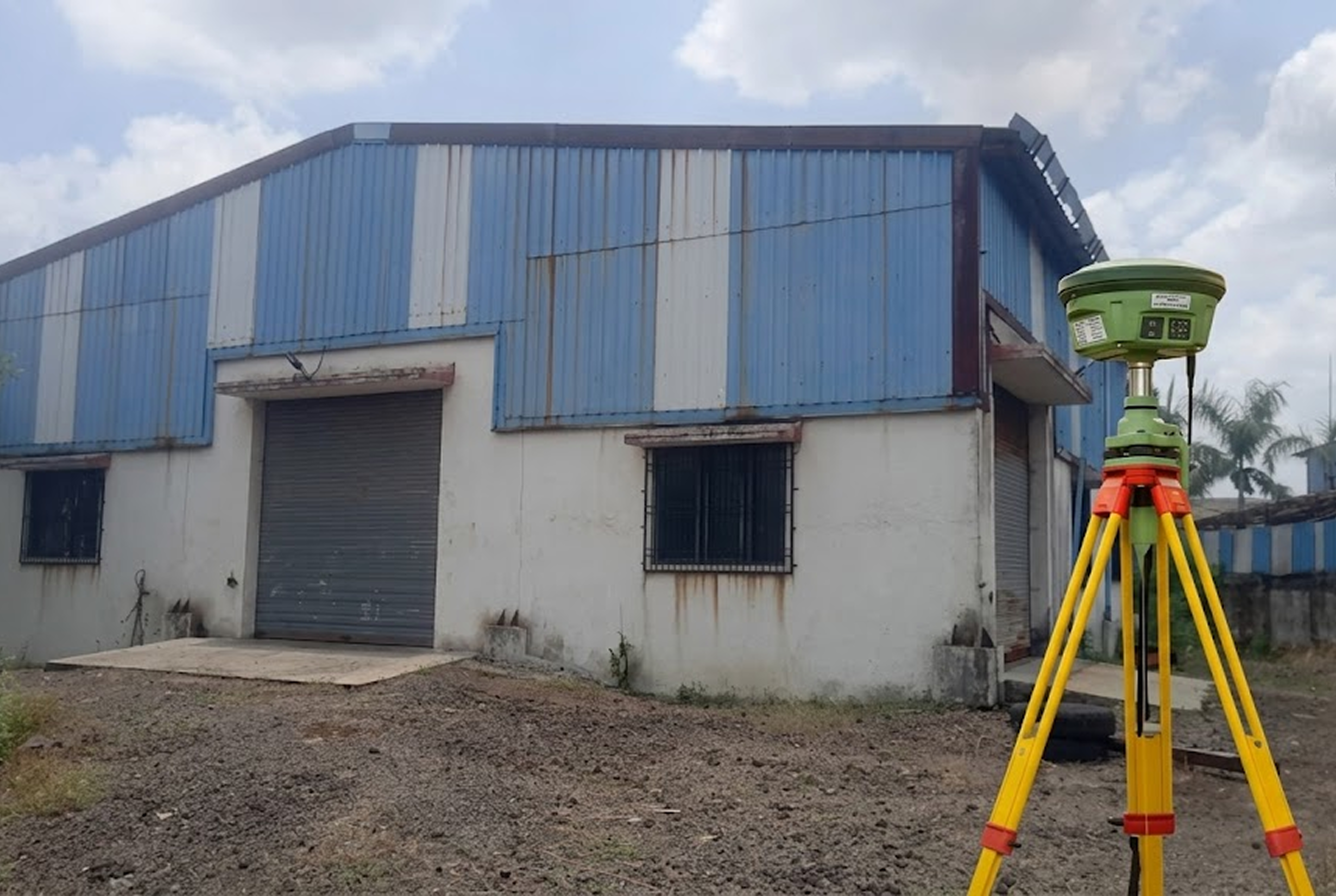
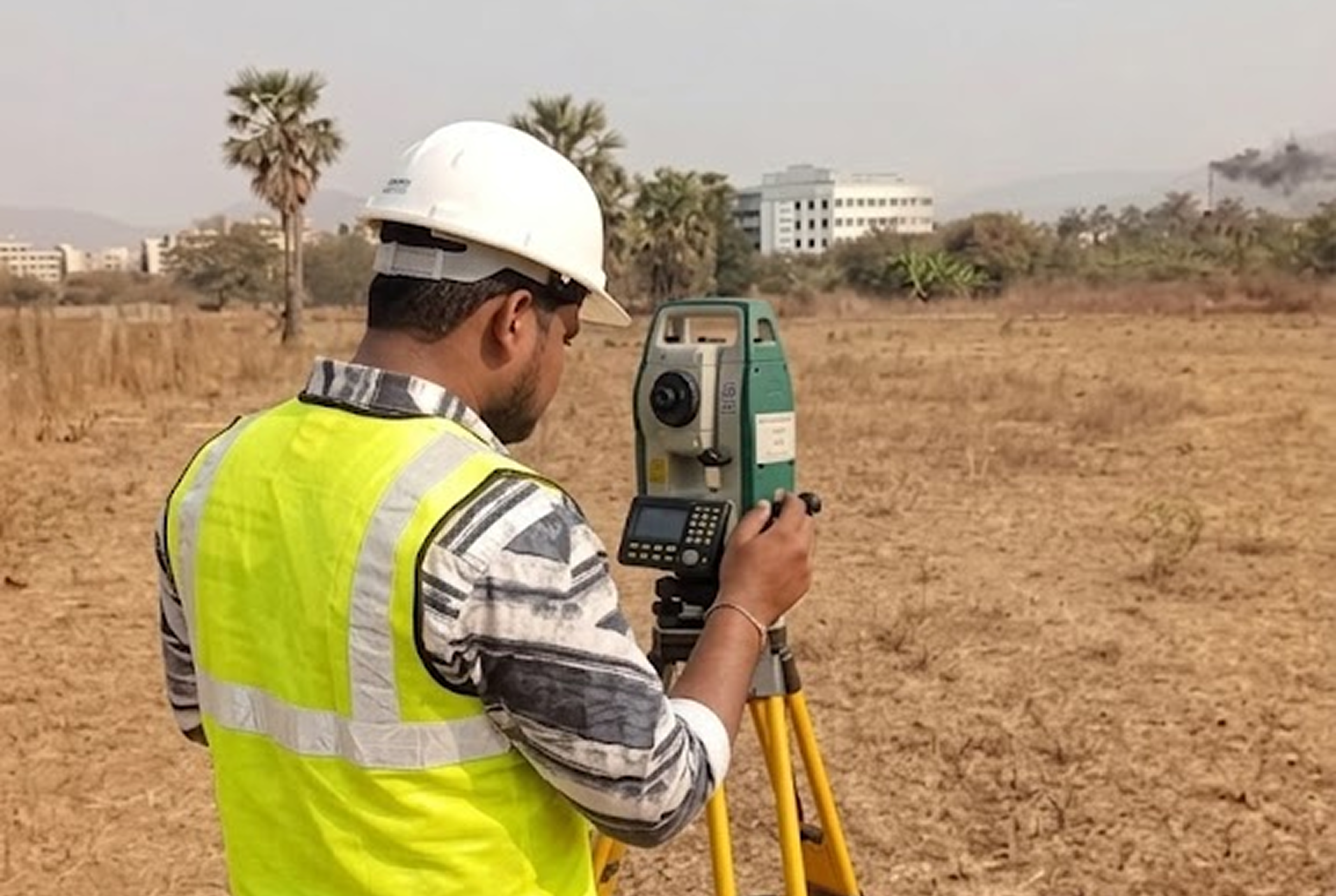
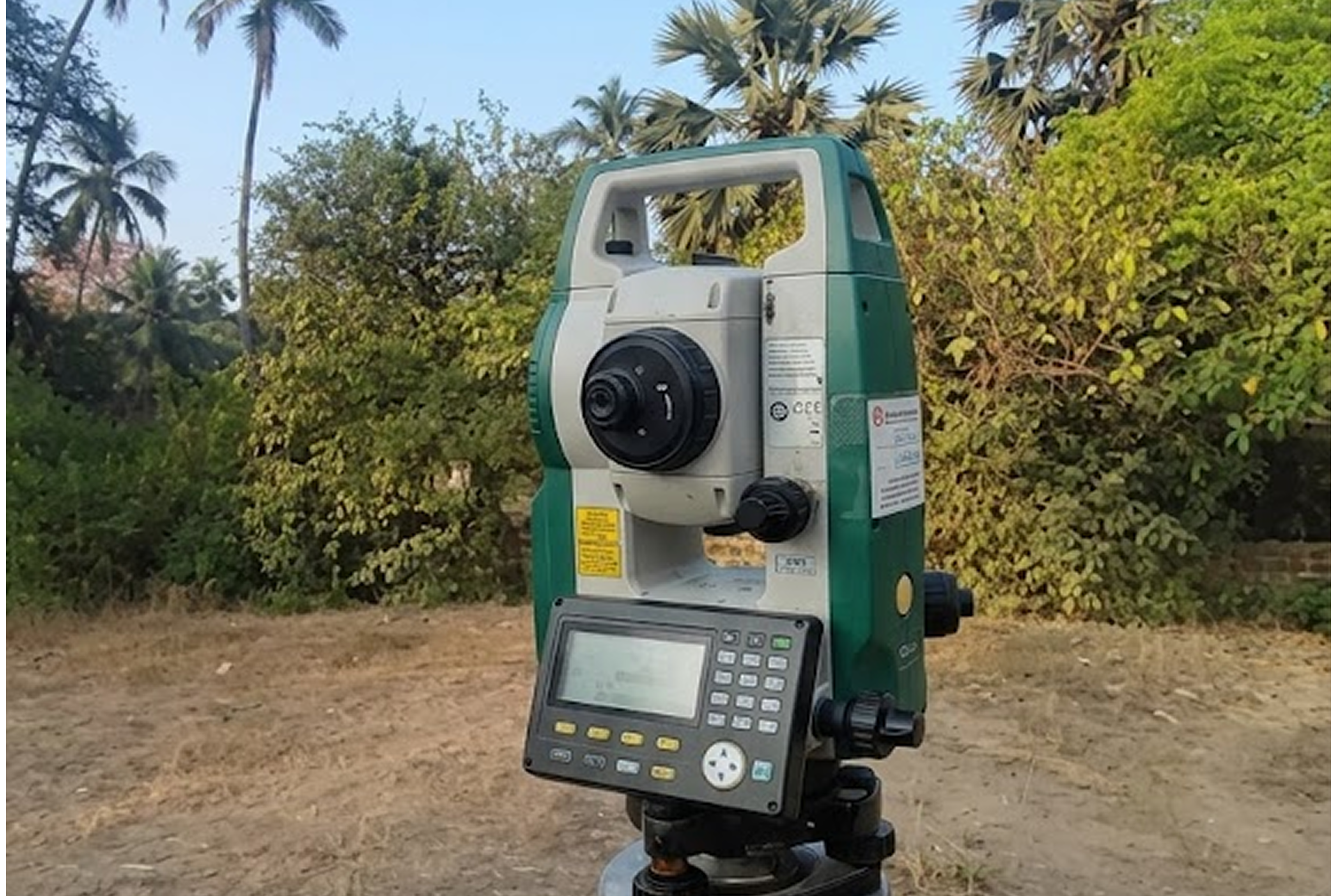
Sub-centimeter GPS precision for large plots, complex boundaries, and high-stakes surveys.
For large plots, development sites, or surveys where conventional measurement isn’t precise enough, Hail Enterprises uses DGPS (Differential GPS) technology — the same standard used in professional engineering and infrastructure projects. Ivan’s Sokkia Total Station and DGPS equipment deliver sub-centimeter accuracy, producing survey data that meets the highest technical and regulatory standards. This is the method of choice for builders, government bodies, and anyone where a margin of error simply isn’t acceptable.